After Congaree, I stayed at the lake for a long time, just getting out in the kayak and getting exercise and sun as much as possible. It was quite nice. Pandemic-created unemployment has its perks. But now, the Long Break is over. I have been recalled to the library, and fall classes at IUS will be starting soon. It's time to get back.
But not without one last adventure! And not to be a broken record, but where better to go than..............a National Park??????
Shenandoah National Park, to be exact, in western Virginia (not be confused with West Virginia). I drove in Saturday via North Carolina, starting at my beloved Charlotte, where I made an out-of-the-way stop for lunch and to see the old places. I cannot describe accurately enough how much I admire that place. I have a fondness for it one cannot fathom. To me it is the greatest city in the world. A shining, gleaming jewel of a city that radiates forth its resplendent light upon all those fortunate enough to see it. It is precious to me, like a child. It shall be as a city upon a hill; the eyes of all people are upon it. It's not bad!
After that, I continued north to my hotel in Waynesboro, just off the southern tip of the national park. I situated myself here because of My Plan for the following day. We'll need a map at this point:
The Plan was to enter at the southern end, then complete the entire Skyline Drive drive up, ending at Front Royal in the north. I'd then take the interstate back from Front Royal to Waynesboro, stopping by the larger town of Staunton, where I had initially planned to stay, but the better deal on a hotel was in Waynesboro, so y'know.
As you can also see, the full Skyline Drive - the roadway through the park - is about three hours of driving, not counting any stops or detours. Interestingly, two highways cross the park, which you can see above, and the three sections are all roughly an hour each. Nice of them to make the divisions even.
Those crossings also allowed for a quick exit to get something to eat, if needed, which they both were after the hotel's woefully insufficient bag breakfast Sunday morning. I'm sorry to complain, because they're doing as much as they can given the situation, where the normal continental breakfast is unworkable. But the tiny, floppy biscuit in plastic wrap, muffin, and apple were all but burnt away by the time I got to my first overlook.
By the by, this is the first National Park I've had to pay for. The others just by chance have been free to enter, but this one cost me a whole thirty bucks.
Skyline Drive more or less is the park; it's the access to all trails and overlooks, which I believe number in the 70s. So the day was one of making my way slowly up and stopping at any and all points of interest. I'd picked out a few can't-miss views, but mostly I was just pulling aside anytime something looked intriguing.
Speaking of the 70s, the weather was mercifully cool for most of the day. In mid July, down at the hotel, the low 90s were not unheard of, but the elevation kept the temperature tolerable until the early afternoon. So that was nice.
My first big stop was Blackrock Summit. Outside, the flowers were in bloom and the air smelled like Easter morning. The short hike brought me to a very rocky crag and back:
Next was Loft Mountain, a campground with a store and a few other amenities, like this amphitheater:
The next point of interest was in the middle third, so when I reached the Swift Run Gap Entrance Station, I took a brief detour to the town of Elkton to get a proper breakfast. Then, it was on to the Byrd Visitor Center.
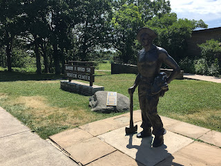
Surprisingly, the visitor center was open, to limited capacity and with a mask requirement, of course. I walked through, but there wasn't much to see, and I wasn't in the market for any trinkets.
Byrd Visitor Center is next to a meadow called Big Meadow. Big Meadow is also the name of the campground nearby, which I didn't see. I did see the namesake meadow, and it is big:
Just past the visitor center is the trailhead to Dark Hollow Falls, the most popular waterfall in the park. It was a couple miles to it, and I realized with a bit of dread after I was maybe 2/3rds of the way there, that the entire trail so far had been downhill. I realized the way back would be an incredible pain.
But the waterfall was very nice. It had a few layers and you could clamber up the rocks to upper pools along the way:
And then the hike back was, predictably, exhausting. It shellacked me. This was especially problematic because, as I was soon to discover, the next and final big point of interest for the day was another steep hike, but this time the uphill portion was first. And it was only about 8 minutes down the road from where I was.
This hike, which was to Hawksbill, the highest peak in the park, nearly killed me. I stopped to rest more times on this trail than I think I have in my entire life up until this point. It may have been the greatest cardiovascular exertion of my life, and I say that as someone who had spent the previous three weeks kayaking every day.
Oh wait. I almost forgot that time on the Great Wall. And the other time. Nevermind.
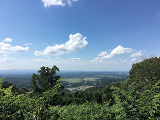
I suspected it was really just the slope; a constant uphill climb with no straightaways. And as proof of this thesis, on my way back down, I didn't stop to rest once. A leisurely breeze! But the view was pretty spectacular from the top:
I made another exit & entrance at the Thornton Gap Entrance Station a little further op the road, again for food, as it was now well past lunchtime. The final third of Skyline Drive didn't have any points of interest I'd found beforehand, so my final hour of winding my way through the park was fairly lowkey, just stopping at the occasional overlook. I did make a stop at Dickey Ridge Visitor Center, the other visitor center in the park, which unlike Byrd, is closed.
At the last overlook of the park, the Shenandoah Valley Overlook, I got a preview of the town of Front Royal, where the north end of Skyline Drive exits:
I'd had this idea in my head that for both Front Royal and Staunton, I was going to get out and explore the town at least a little, but I've gotta say, I was totally beat at the end of that day. Not to mention it was way later than I ever though it might get, roughly 6:30 by the time I'd returned to the hotel after my interstate drive back south. So both of those small towns got just a ride-through from me.
Dinner, then bed, then the next morning I treated myself to a large breakfast from the Cracker Barrel next door. Probably not the morning that needed extra sustenance, but oh well. I did have a drive to make. I had decided to split this final leg roughly in half in the town of Huntington, West Virginia, because otherwise it would have been a fairly long day of driving to get back. Then after that, my very long time away from Louisville would be over.
But I think I was ready to get back.


No comments:
Post a Comment